I witnessed the launch of the Fly the Jalur Gemilang Campaign held at Dataran Pahlawan, Malacca today in conjunction with Malaysia's upcoming 50th independence anniversary. This event was attended by Prime Minister Datuk Seri Abdullah Ahmad Badawi and other national leaders. For more information about this event, read these news articles:
200,000 Throng Melaka's Dataran Pahlawan For Merdeka Celebrations - Bernama
Abdullah leads vintage motorcade - NST
At 6 pm, I walked across Malacca River to Dataran Pahlawan. My car was parked as far as possible away from the location of this event, because the roads may be blocked due to the crowd. Along the way, I managed to grab these photos: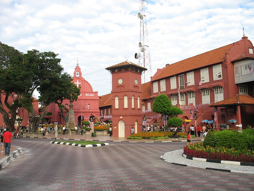
This is the famous Tan Beng Swee Clock Tower of Malacca. Not far away are the Stadhuys, Queen Victoria's Fountain and Christ Church. (Ref. No.: IMG_33590001)
Time: 6.25 pm
Photographer's location: 2.194394° N, 102.248552° E
[Large view][Exif data]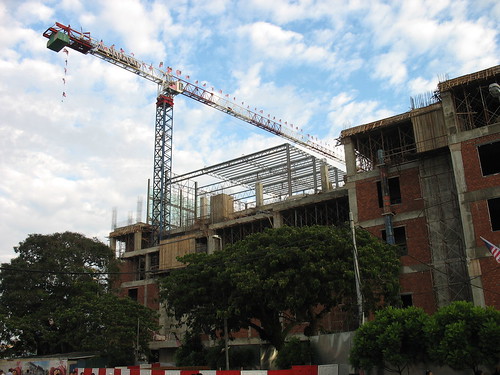
The uncompleted part of Dataran Pahlawan under construction. (Ref. No.: IMG_33600001)
Time: 6.41 pm
Photographer's location: 2.190983° N, 102.252308° E
[Large view][Exif data]
At about 8 pm, cars of VIPs and special guests started arriving at Dataran Pahlawan. I was standing in front of Bastion House (Location: 2.191436°N, 102.250000°E) and I took pictures of them passing by.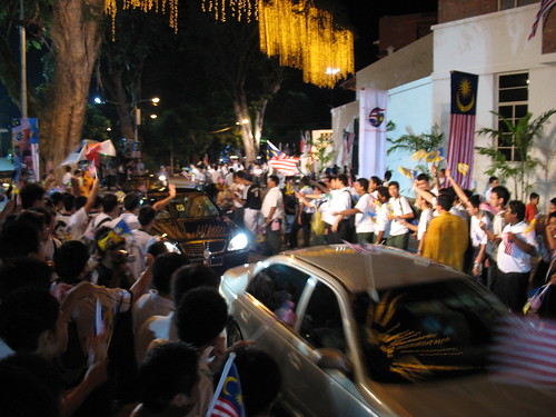
(Ref. No.: IMG_33620001)
Time: 8.06 pm
[Large view][Exif data]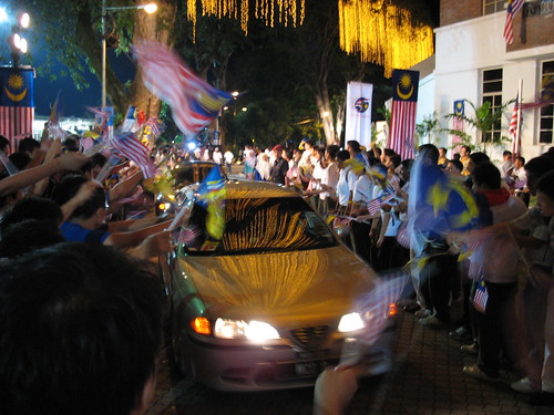
(Ref. No.: IMG_33660001)
Time: 8.13 pm
[Large view][Exif data]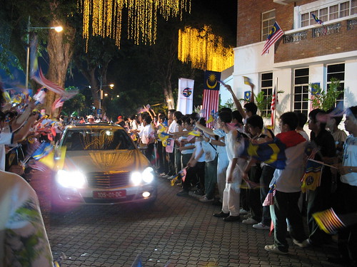
(Ref. No.: IMG_33670001)
Time: 8.16 pm
[Large view][Exif data]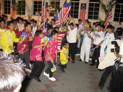
(Ref. No.: IMG_33690001)
Time: 8.20 pm
[Large view][Exif data]
While waiting for the Prime Minister...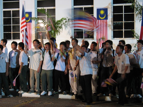
Students from St. Francis Institution nearby waving the Jalur Gemilang and singing patriotic songs. (Ref. No.: IMG_33700001)
Time: 8.26 pm
[Large view][Exif data]
At around 9.17 pm, the Prime Minister's motorcade approached the place I was standing. His car is a vintage Nash Rambler Custom Convertible 1951 and bore the registration number M 4442. The car also carried Chief Minister Datuk Seri Mohd Ali Rustam and Culture Arts and Heritage Minister Datuk Seri Rais Yatim.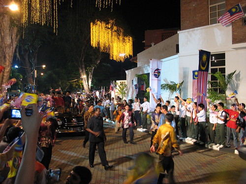
(Ref. No.: IMG_33800001)
Time: 9.17 pm
[Large view][Exif data]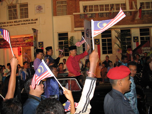
From left: Datuk Seri Rais Yatim, Datuk Seri Mohd Ali Rustam and Datuk Seri Abdullah Ahmad Badawi. (Ref. No.: IMG_33820001)
Time: 9.17 pm
[Large view][Exif data]
Following the Prime Minister is a procession of antique cars and motorbikes.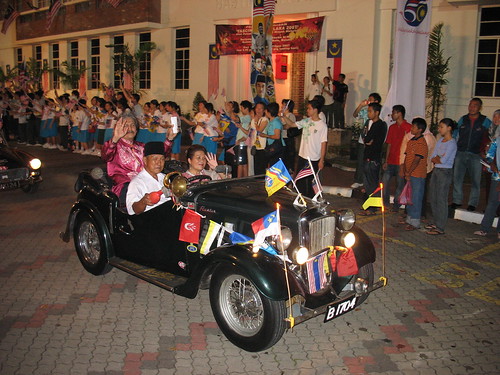
(Ref. No.: IMG_33830001)
Time: 9.18 pm
[Large view][Exif data]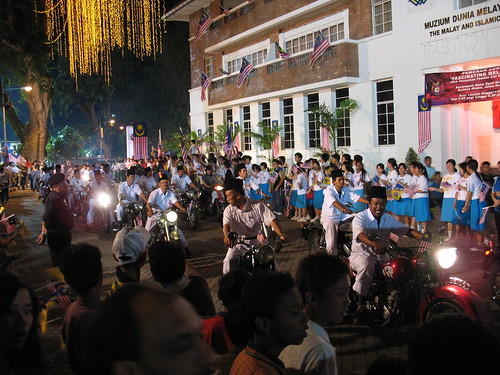
(Ref. No.: IMG_33850001)
Time: 9.19 pm
[Large view][Exif data]
After the motorcade left, I set out towards the top of Dataran Pahlawan.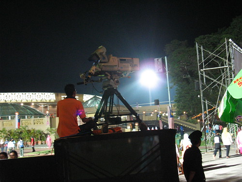
An RTM cameraman at the scene. (Ref. No.: IMG_33910001)
Time: 9.29 pm
Photographer's location: 2.191406° N, 102.250611° E
[Large view][Exif data]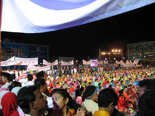
The crowd on top of Dataran Pahlawan. At the centre are performers in colourful traditional clothes. Surrounding them are people holding banners with writings similar to those in 1957 when Malaysia obtained independence. (Ref. No.: IMG_33920001)
Time: 9.34 pm
[Large view][Exif data]
I left the place at 10 pm, before the event ended.
Key Places View in Google Earth (KML)
* All times are in MYT (GMT +0800).
Friday, 17 August 2007
50th Merdeka Celebrations at Dataran Pahlawan
Posted by Polywj at 11:00 0 comments
Sunday, 29 July 2007
Down Malacca River
This evening, I took a stroll along Malacca River (Malay: Sungai Melaka), which have undergone beautification for the past few years.
From my starting point north of Kampung Morten ("kampung" means village in Malay), I walked down south towards the Hang Tuah Bridge and turned back to my starting point again.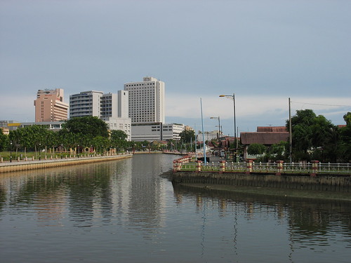
Malacca River. On the left is Kampung Morten. The three tall buildings which are visible (from left) are Bayview Hotel, Putra Specialist Hospital and Renaissance Hotel. (Ref. No.: IMG_33500001)
Time: 5.56 pm
Photographer's location: 2.206092° N, 102.250775° E2.206092102.250775
[Large view][Exif data]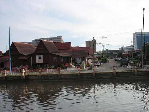
Kampung Morten and its characteristic Malay-style houses. (Ref. No.: IMG_33510001)
Time: 5.59 pm
Photographer's location: 2.204617° N, 102.251342° E2.204617102.251342
[Large view][Exif data]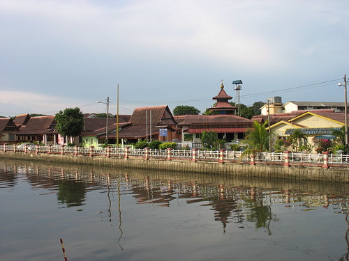
More of Kampung Morten. The building with a pointed roof is the local mosque. (Ref. No.: IMG_33530001)
Time: 6.05 pm
[Large view][Exif data]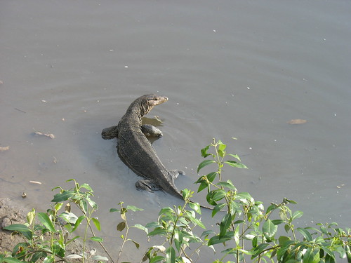
A monitor lizard seen at the shallow part of the river. (Ref. No.: IMG_33540001)
Time: 6.10 pm
[Large view][Exif data]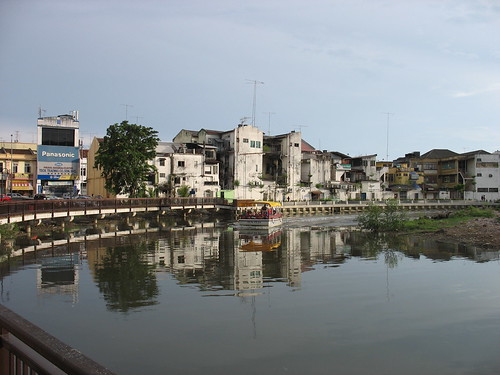
A boat seen cruising along the river carrying sightseers. (Ref. No.: IMG_33550001)
Time: 6.13 pm
Photographer's location: 2.201439° N, 102.249911° E2.201439102.249911
[Large view][Exif data]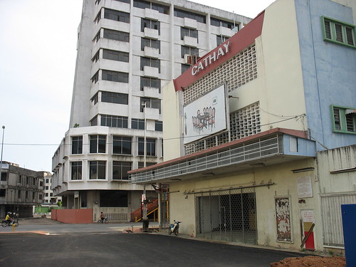
The old Cathay Cinema building. It was used as a furniture shop before being abandoned. (Ref. No.: IMG_33560001)
Time: 6.18 pm
Photographer's location: 2.200522° N, 102.248986° E2.200522102.248986
[Large view][Exif data]
A few metres after the cinema, I turned back following my original path. I took one last photo.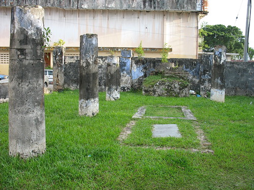
The ruins of Rosary Chapel built by the Portuguese. (Ref. No.: IMG_33570001)
Time: 6.29 pm
Photographer's location: 2.201875° N, 102.251192° E 2.201875102.251192
[Large view][Exif data]
For a brief introduction and history of Rosary Chapel, read the following news article:
Ruins with interesting tales - AllMalaysia.info
Key Places View in Google Earth (KML)
* All times are in MYT (GMT +0800).
Thursday, 22 February 2007
Pangkor Trip '07 - Day 3 - Back to Lumut
This post is part of the Pangkor Trip 2007 series.
Day 1 Lumut · Approaching Pangkor Island · Havana Beach Resort · Nipah Bay Beach · Dinner Day 2 More Hornbills · Boat Ride & Pulau Giam · White Tom Yam Day 3 A Fireworm · Back to Lumut
At noon, I was already packing my belongings and about to say goodbye to the folks on Pangkor Island. The trip from Havana Beach Resort to Pangkor Jetty in Pangkor Town was on board a taxi. I was soon waiting to take a ferry back to Lumut.

Part of a fishing village near Pangkor Jetty. (Ref. No.: IMG_32890001)
Time: 12.21 pm
Photographer's location: 4.213386° N, 100.576869° E4.213386100.576869
[Large view][Exif data]
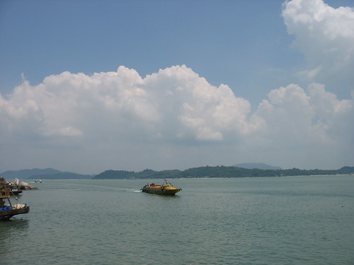
A ferry approaching Pangkor Jetty. (Ref. No.: IMG_32930001)
Time: 12.59 pm
[Large view][Exif data]
An hour later, I was back at Lumut.
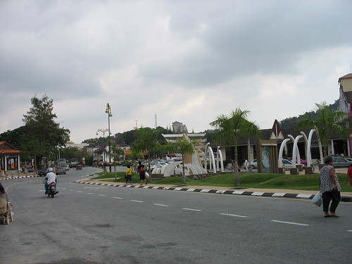
A road leading away from Lumut Ferry Terminal. (Ref. No.: IMG_32950001)
Time: 2.04 pm
Photographer's location: 4.2362° N, 100.6329° E4.2362100.6329
[Large view][Exif data]
This was the end of Pangkor Trip 2007.
Key Places
 View in Google Earth (KML)
Posted by Polywj at 14:29 0 comments
Labels: malaysia, pangkor, Pangkor Trip `07, perak

